Surveilling Surveillance

Surveillance cameras are increasingly threatening our privacy. Computer vision can tell us where they are and who is most affected.

Read our paper here.

There are over 10,000 outdoor surveillance cameras in New York City alone

Surveillance cameras are everywhere. Governments, businesses and homeowners all use cameras to detect and potentially deter crime. But advances in facial recognition, predictive policing, and hacking make cameras an increasing threat on our privacy.

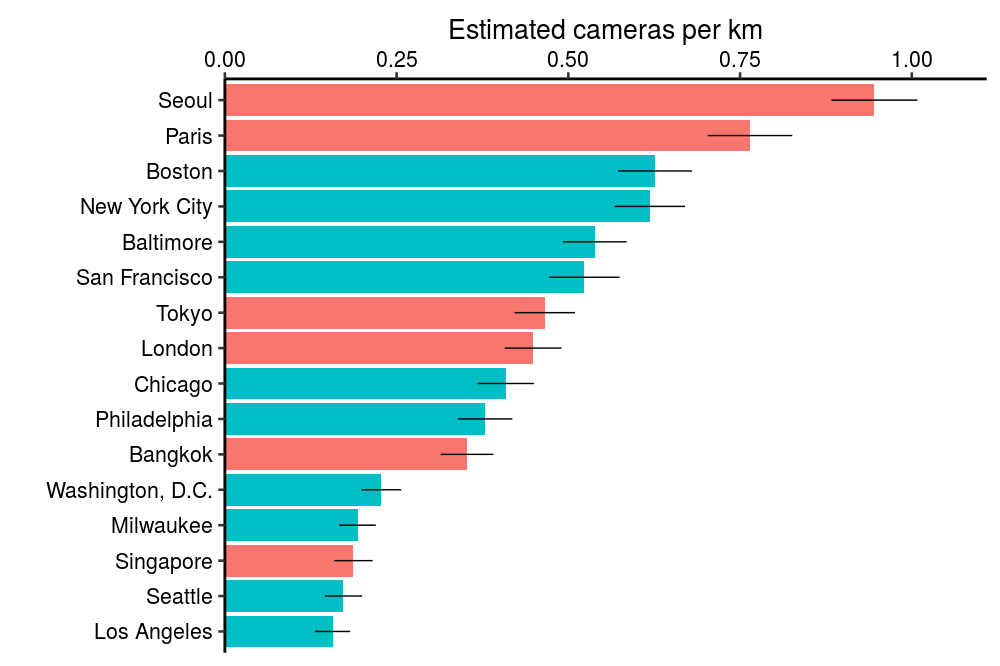
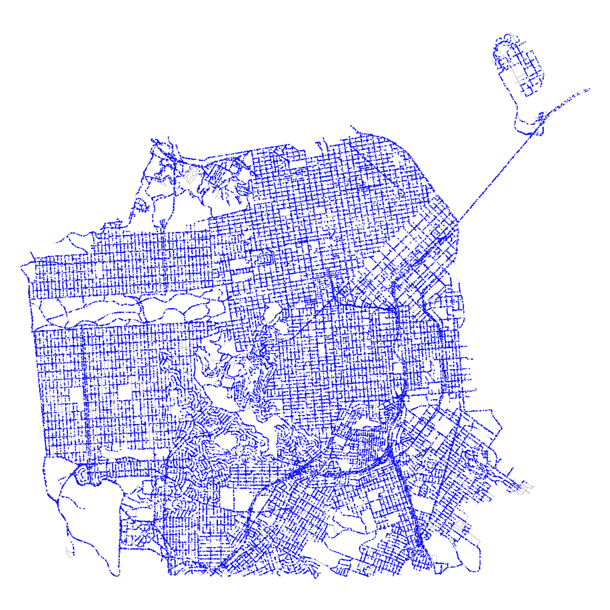
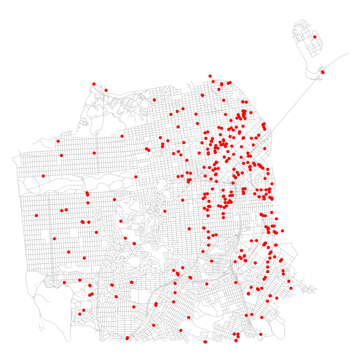
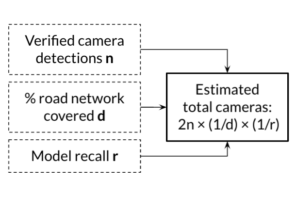
Using computer vision, we analyzed over 1 million images to estimate the number of cameras in 10 large U.S. cities and 6 other major cities around the world. We find large differences in camera density between cities, ranging from 0.2 cameras/km in Los Angeles to 0.9 cameras/km in Seoul.

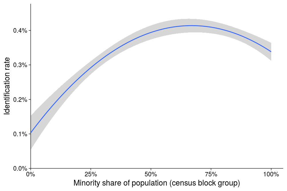
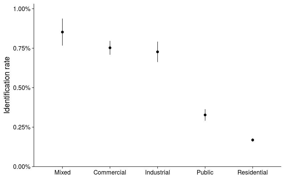
We also find that cameras are concentrated in commercial and industrial zones, and in communities of color, even after adjusting for zone.

Here's how we did it

Figure of road_network
1. Uniformly sample points from the road network
Figure of segment
2. Find an image at each location with Google Maps
Figure of model_detection
3. Run our camera detection model on the image
Figure of human_detection
4. Verify machine detections manually
Figure of show_all
5. Repeat to find all the cameras in the sample
Figure of estimate
6. Use statistical model to generate estimates for the city

Here's where the cameras are

We analyzed 100,000 images taken at random locations in each of the 16 cities we considered. The markers on the map show where we found cameras in these random samples. Click on the markers to see the camera at that location. Use the dropdown to navigate to different cities we studied.

We detected more cameras in commercial and minority neighborhoods

The maps show that cameras are clustered in certain areas of each city. To understand these patterns, we estimated the density of cameras by zone and racial composition.

We find that images of mixed, industrial and commercial zones are more likely to contain cameras than public and residential areas.

We also find that an increase in the share of minority residents in a neighborhood is associated with an increase in camera detection rate. This persists even after adjusting for the zone category. These results show that communities of color are more likely to experience the impacts of video surveillance.

People

Image of Ro Encarnación

Ro Encarnación

Software Engineer

Computational Policy Lab

Stanford University

Image of Sharad Goel

Sharad Goel

Assistant Professor

Management Science & Engineering

Stanford University

Image of Joe Nudell

Joe Nudell

Lead Engineer

Computational Policy Lab

Stanford University

Image of Hao Sheng

Hao Sheng

Ph.D. Candidate

Computational and Mathematical Engineering

Stanford University

Image of Keniel Yao

Keniel Yao

Data Scientist

Computational Policy Lab

Stanford University